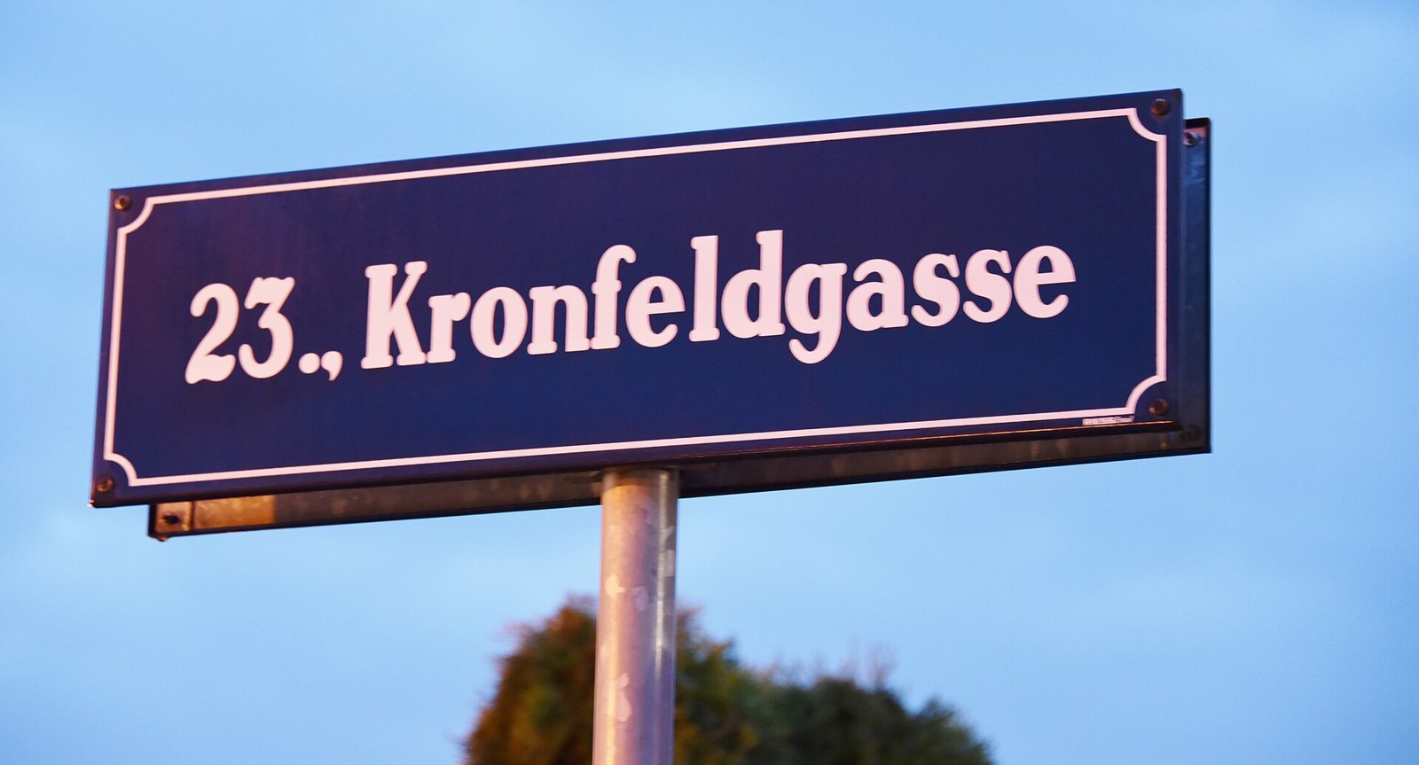
How are Vienna’s districts numbered?
Vienna has 23 districts, called Bezirke (singular Bezirk). Each carries both a number and a name — the 7th district is Neubau, the 1st is Innere Stadt. The numbers spiral outward clockwise from the center. That pattern is real, but it only holds cleanly through district 9. Past that point, the number stops describing geography and starts describing history.
Where does the clockwise spiral actually break?
Districts 1 through 9 are the reliable part. Innere Stadt (1) sits at the core. Leopoldstadt (2), Landstraße (3), Wieden (4) and the rest follow it clockwise, ring by ring, out to Alsergrund (9). This is the version of Vienna’s district map every guidebook shows, and for those nine districts it’s accurate.
Beyond district 9, the spiral gets shaky. Districts 10 through 19 mostly still cluster where a compass would put them — south, then west, then north. But four later districts break the pattern outright. Brigittenau (20) sits near the center, not further out where its number implies. Floridsdorf (21) jumps north across the Danube. Donaustadt (22) lies east of the river — arguably it should come before Floridsdorf in true clockwise order, not after. Liesing (23) lands in the far south, nowhere near district 22’s neighborhood.
The reason is simple. These districts don’t record position. They record the order in which surrounding towns became part of Vienna.
| District | Name | How it entered Vienna | Approx. date |
|---|---|---|---|
| 10 | Favoriten | Split off from adjoining inner districts | 1874 |
| 11 | Simmering | Outer suburb (Vorort) annexation | 1890–92 |
| 12 | Meidling | Outer suburb annexation | 1890–92 |
| 13 | Hietzing | Outer suburb annexation | 1890–92 |
| 14 | Penzing | Outer suburb annexation | 1890–92 |
| 15 | Rudolfsheim-Fünfhaus | Outer suburb annexation | 1890–92 |
| 16 | Ottakring | Outer suburb annexation | 1890–92 |
| 17 | Hernals | Outer suburb annexation | 1890–92 |
| 18 | Währing | Outer suburb annexation | 1890–92 |
| 19 | Döbling | Outer suburb annexation | 1890–92 |
| 20 | Brigittenau | Split off from Leopoldstadt | 1900 |
| 21 | Floridsdorf | Annexed across the Danube | 1904–05 |
| 22 | Donaustadt | Greater Vienna expansion, boundaries revised | 1938, revised 1954 |
| 23 | Liesing | Greater Vienna expansion, retained after revision | 1938, retained 1954 |
Of the fourteen districts numbered 10 to 23, close to half — Brigittenau, Floridsdorf, Donaustadt and Liesing among them — sit out of clockwise sequence with their numerical neighbors. Guess a district’s location from its number alone, once you’re past single digits, and the odds are close to even that you’ll be wrong.
Why do districts 22 and 23 look bolted on?
Both owe their place in the numbering to politics, not geography. In 1938, the Nazi-era “Greater Vienna” law annexed dozens of surrounding Lower Austrian municipalities in a single stroke, briefly pushing the city’s district count above twenty. The City of Vienna’s own account of its administrative history describes this expansion and the boundary revisions that followed in 1954, which handed some annexed areas back to Lower Austria and settled the map at 23 districts.
Donaustadt and Liesing kept the numbers they’d been given in that reorganization. Donaustadt, the district that breaks the spiral hardest, is also Vienna’s largest by area — well over 100 square kilometers, according to figures published by Statistics Austria — because it absorbed large stretches of undeveloped land along the Danube during the 1938 expansion. Nothing about its number reflects that; it simply came after 21 in the paperwork.
Does the district number still tell you anything useful?
Yes — mainly through the postal code, not the map. Vienna’s postcodes are built directly from the district number: take 1, add the two-digit district number, add a final 0. District 7, Neubau, is postcode 1070. District 19, Döbling, is 1190. That part of the system is completely mechanical and won’t mislead you.
The number is far less useful as a stand-in for cost, density or character. A low number does tend to mean older buildings and higher density near the center. A high number can mean either a dense 1890s suburb (Ottakring, 16) or a district that’s mostly parkland and allotments (Donaustadt, 22). The number doesn’t distinguish between them — only the name does. Resources like Access Vienna’s guide to the city’s neighborhoods and landmarks are built around the names for exactly this reason.
What does this mean for finding an address or moving here?
For a visitor, the practical upshot is small: don’t assume adjacent numbers mean adjacent places, past district 9. Check a map, or use the district name rather than the number when searching for something. Public transport largely erases the district issue anyway, since Vienna’s fare system is zone-based rather than district-based — see how Vienna’s public transport fare system actually works for how that’s structured, and the Getting Around archive for more on the network itself.
For a resident, the number matters administratively. Each district has its own Magistratisches Bezirksamt (district office), and that’s where certain registrations — including the address registration described in Access Vienna’s guide to the Meldezettel — actually get filed. It also affects which local council you fall under for anything district-specific, from schools to waste collection points; see how waste separation actually works in Vienna for how that system is organized.
More broadly, the number is a piece of Vienna’s administrative history sitting in plain sight on every street sign. For a fuller sense of how the districts function day to day, the Living in Vienna hub and the Living in Vienna archive cover the parts of daily life the numbering alone doesn’t explain. For trip planning across the city more generally, Access Vienna’s practical planning hub is the wider starting point.
Access Vienna is an independent guide written from published, checkable sources. We have not visited the places described here and we do not publish personal recommendations or invented ‘local favorites’ — where something is singled out as notable, we say who says so. Opening times, fares, closures and prices change at short notice, so treat everything here as a starting point and confirm with the museum, operator or venue directly before building a day around it. We give no advice on visas, insurance, health or safety; use your own government’s official guidance for those.
Featured image: “Straßenschild Kronfeldgasse (Wien)” by Christian Michelides, via Wikimedia Commons, CC BY-SA 4.0.
.jpg)